How Apple's new vector-based Maps leave Google Maps looking jittery
 Daniel Eran Dilger
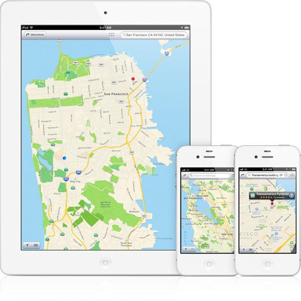
The previous segment, Apple wants to wipe Google off the map with iOS 6, described Apple's iOS 6 strategy of cutting ties with Google's map servers and instead powering its own iPhone and iPad Maps client apps (as well as all third party apps that use iOS' built-in mapping services) with mapping servers it manages and operates on its own.
Apple's new mapping services powering the revamped Maps app iOS 6 are based on a series of partnerships, acquisitions and internal work that are intended to not just replace the existing maps data Google has been serving up for iOS users over the past half decade, but to also expand and improve upon the features available.
Vectors are the new map
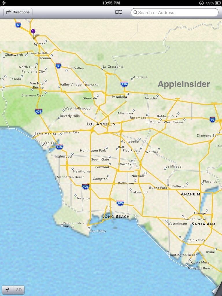
The first primary technology advancement Apple will be introducing for iOS 6 Maps relates to the use of resolution independent vector images. This allows users to smoothly zoom in with a pinch of the fingers, while details and labels pop up as space allows. Google's existing map services are based on a series of fixed zoom levels, so when users zoom in, they see the existing map turn into a blurry image that is incrementally repainted with the next zoom level as it downloads (below, during a refresh).
Each fixed zoom level of Google's map data is made up of bitmapped graphics. That results in labels (such as neighborhood or street names) being fixed in position and orientation, so when the map is rotated (such as by the compass), the labels may appear upside down. Zoomed in or out, labels may also be left illegible by rough-looking scaling or obscured by overlay information such as the direction path drawn on top of the map.
Google does a pretty good job of quickly serving up replacement map tiles as users zoom in and out, but this process can be complicated by slow data networks that don't have the bandwidth to serve up tiles fast enough.
Modern iOS devices do a pretty good job of caching a bit of Google's map data so you can load a map of the area you will be visiting and then navigate around using GPS even if you lack a mobile connection. However, while Google does support offline maps on its own Android platform, there's no way to load a specific set of maps at arbitrary zoom levels in iOS Maps, so you can only load up a relatively small area and hope the system doesn't automatically discard any of the maps you want to view offline.
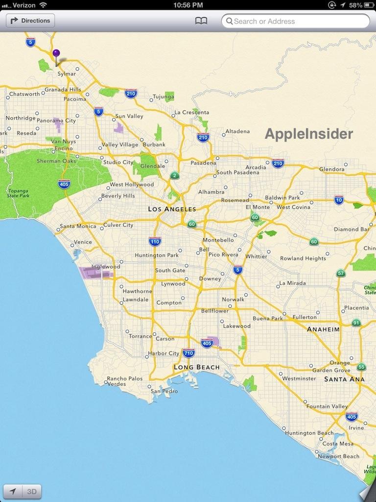
When using to vector maps, all coastlines, roads, labels and other data are represented as mathematical lines rather than as fixed graphic images. This enables Apple to allow users to freely rotate the map however they want; the text of map labels dynamically reorients itself to remain legible. When users zoom in or out, the text size of labels scales smoothly, because it is being rendered live as dynamic text, not as a graphic image that includes text and must be "repainted" for every zoom level.
On page 2 of 3: I can see for miles and miles
Even better, highly efficient vector maps allows Apple to load up a large area of maps you can continue to zoom into even after you've entered Airplane Mode. This means that if you load a map of San Francisco then turn off network access, you can still zoom in and out all over a very large surrounding area without getting Google's zoomed in jaggies and blank grid spaces.
Apple's iOS 6 Maps app still complains when there's no data connection, but it will let you continue to zoom in and out of nearby areas you haven't even previously visited, because it can continue to smoothly render the efficiently lean vector map data it has loaded.
After loading San Francisco and going offline, one can browse over 300 miles (480 km) south (nearly to Los Angeles), 335 miles (540 km) north to the Oregon border, and 300 miles east to the middle of Nevada, down to the primary city street level (in sharp detail but with few road labels).
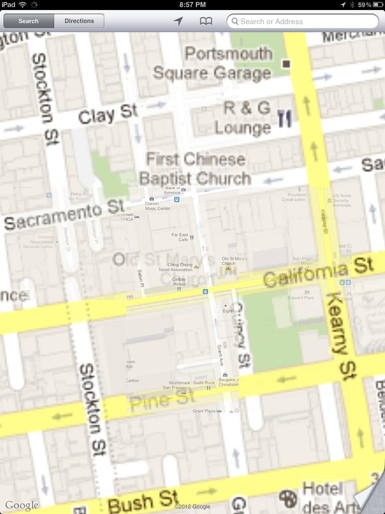
Attempting the same task on an existing iPad, Google's bitmapped maps run out of steam just 35 miles (56 km) away in Palo Alto (below), and on the edge of its cached area, images degrade poorly when zooming, with blurry text and jagged road lines.
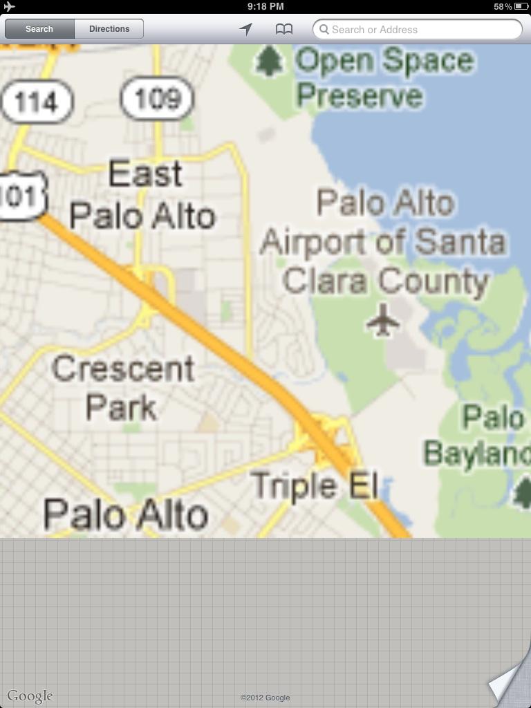
Apple's new vector maps can deal far more gracefully with a lost data connection, allowing you to zoom in and see details with clarity, even when you can't load local details such as secondary road names (below, the same area offline).
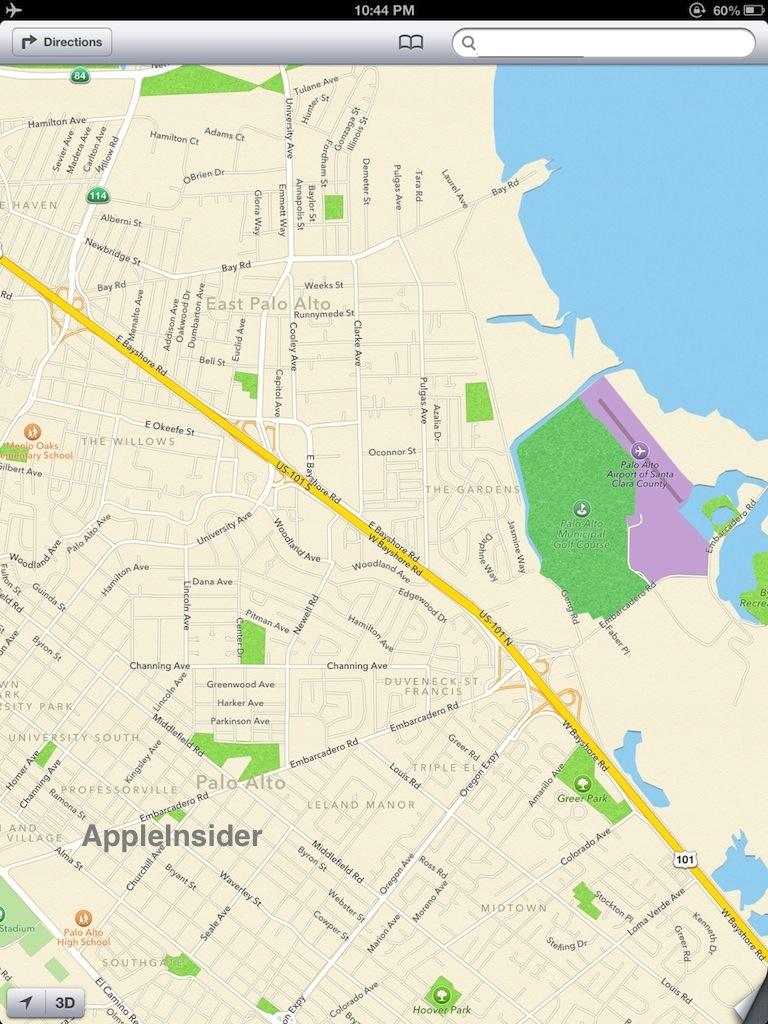
After loading San Francisco and turning off data, Apple's vector data could coast offline all the way down to LA (380 miles, 611 km) before degrading to the point of not being useful (below top, vs. restored data connection below bottom).
On page 3 of 3: A brief history of Google Maps and iOS
Apple originally partnered with Google to deliver maps on the iPhone, but is now taking over iOS Maps entirely, launching its own mapping servers at the critical point where vector graphics (among other technologies) have the potential to revolutionize mobile maps. Here's a brief overview of how Apple's partnership with Google has unraveled.
Google acquired Where 2 Technologies in 2004 to release its initial web app for online maps, relying heavily on JavaScript and AJAX technologies to enable map zooming and exploration features on the web that nobody had ever seen before.
Over the next two years, Google rapidly enhanced its Google Maps website and began incorporating a variety of unique features including plotting directions between multiple directions, as well as adding building outline models and subway stops for some cities. In 2006, Google launched Maps for Mobile, a mobile Java app intended for use with mobile phones (at a time when mobile devices didn't have very functional web browsers).
The next year, Apple debuted the original iPhone, running a custom Maps client app making intuitive use of touch controls for navigation and zoom. Apple's Maps app, developed in-house using the iPhone's native Cocoa Touch, relied upon Google's open API for obtaining map data, but presented and navigated that data in an entirely new way.
Within the first year, Apple's iOS Maps app added the ability to pinpoint the user's location, using GPS or WiFi/cell tower geolocation. In late 2008 Apple introduced iOS 2.2 with support for Google's StreetView as well as adding walking and transit directions. In 2009's iOS 3, Apple added APIs for developers to incorporate mapping features within their own apps.
With the release of iPad in 2010, Apple added Google's terrain view to the iPad-only iOS 3.2, but never brought that feature to iPhone users. In last year's iOS 5, Apple added alternative route options and Google's real time traffic information.
Over the same five years, Google added a variety of new features to its web and mobile mapping apps, many of which Apple did not support in its native Maps app. In fact, as Google focused its attention on delivering Android as a competitor to the iPhone, it began launching new map features exclusively on Android as differentiating features iOS didn't have.
For example, a primary marketing feature of Android 1.0 was its new compass support, which Google demonstrated as a way to navigate StreetView images by orbiting a phone around oneself awkwardly at arm's length, making for a cool demonstration, if not a very useful feature. Apple's own support for compass features and StreetView followed a few months later in iOS 2.2, but Apple used the digital compass to orient maps or drive the new Compass app, leaving StreetView as something you'd navigate with your finger.
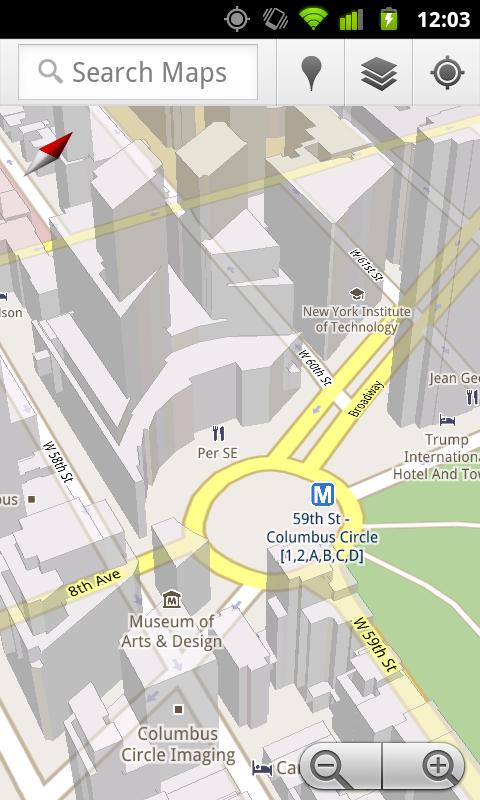
In 2009 Google launched Android 2.0 with a series of exclusive mapping features, including voice prompted, turn-by-turn navigation features; voice search; searching for items along a plotted route and 3D models (below).
Apple appeared set to adopt those features as it had the previous year. In late 2009, a Google spokesperson told AppleInsider "Apple is a close partner. Millions of users experience Google Maps on the iPhone. We will continue to work with Apple to bring innovation, including Latitude and Navigation, to users but you'll have to speak to Apple about availability."
Instead, Apple began plotting its own next move in maps, no doubt concerned that additional dependence upon Google would eventually put it in a very difficult competitive position.
Google continued to tie its map services into other related businesses, including its Yelp-like Local search and Loopt-like Latitude services. It has also added or enhanced direction information tailored to public transit, walking or biking, added 3D building models, offline maps and has announced 3D renderings of some cities. Apple has selectively ignored many of these features in its own iOS Maps app as it worked to put together its own mapping system.
Apple puts together its own map team
Since 2009, Apple has only acquired a dozen different smaller companies. A quarter of these highly selective, strategic moves involved mapping companies. In July 2009 Apple bought Placebase, followed by Poly9 the next July. In August 2011, it bought C3 Technologies, known for work in developing 3D images based on aerial or satellite images.
It's notable that most of Apple's other known acquisitions were rapidly converted into key product features, from Lala (which made its way into iTunes Match) to Quattro Wireless (iAd) to Polar Rose (camera face recognition), IMSense (iPhone HDR) and Siri. This helped support the prediction that Apple was intently interested in replacing Google's maps services.
But Apple didn't just want to clone Google Maps. It made plans to replace it with superior technology. By delivering maps as vector graphics, rather than static bit maps, Apple realized it could enhance the navigation experience and take fuller advantage of the graphics capabilities of its newest mobile devices.
In addition to smoothly accommodating any zoom level without getting jaggies and having to download new tile data, vector map data can also draw text labels very legibly in a way that accommodates the drawing of additional layers of data on top, such as labeled businesses, building outlines, and direction path lines that don't obscure map information.
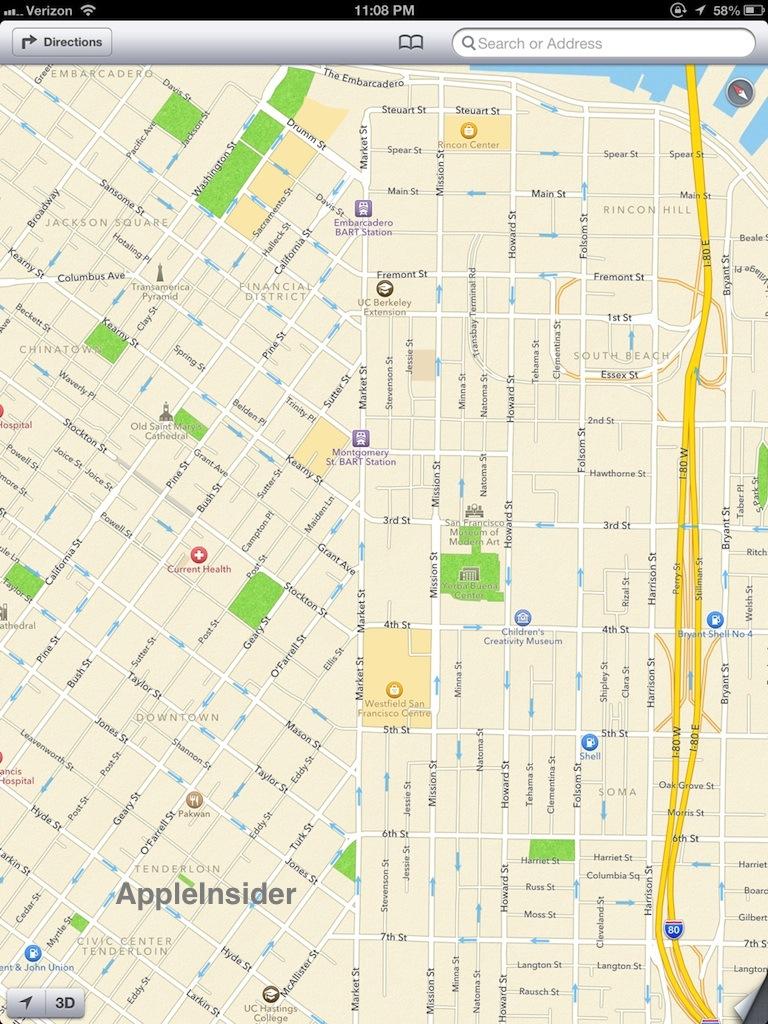
Users can also spin the map with a two-fingered rotational gesture. As the map rotates, labels can turn to remain legible. A compass icon points north; tapping it reorients the map to face north (below: two rotated views of Market Street, San Francisco. Map labels reorient to remain legible as you rotate the map; below top is rotated so it shows a compass icon, bottom image faces north).

A new battle for Maps territory
Google is also working on its own next generation Google Maps that makes use of vectors, but it has a more difficult job because it is targeting several major platforms: the web, which relies upon the experimental new MapsGL enhancements of WebGL; Android, which has a native JavaME-like platform; and its existing public API, which is rooted in how Google Maps has worked in the past.
Apple can introduce entirely new technologies very rapidly because it only has to optimize for one platform: iOS Cocoa Touch. Apple isn't serving up a public web version of its own maps as Google does, so it isn't constrained by the limits of web-based technologies.
Apple does have a public API for iOS Maps, but third parties don't just request raw map data through it; Apple's iOS takes care of the underlying complexities when a third party app requests to plot a location on a map, so it's not an extremely difficult task for Apple to adjust those APIs to work with its own map data rather than Google's.
When iOS 6 ships later this fall, Apple will essentially take away about half of Google's mobile maps users, and virtually all of its iOS users. When Apple ships its own Cocoa version of Maps for Mac OS X users, Google will likely lose another valuable segment of desktop users as well. This new competition should push Google to deliver mapping tools that iOS and OS X users will want to go out of their way to download and use.
At the same time, Apple is now on the brink of inheriting a huge new business, one that will require it to remain competitive in maps if it expects to retain users' attentions. Last fall, the company did virtually the same thing with Siri voice assistance, jumping from dead last in mobile voice services to being the top vendor with a comfortable lead that Google and Microsoft are now struggling to match with their own simpler, basic voice recognition systems.
Jumping to the next generation of maps with vector-based graphics will give Apple a similar technological lead over today's existing mapping servers. But vectors aren't the only new technology Apple is leveraging to launch its new iOS 6 Maps service, as the next segment will explore.


 Mike Wuerthele
 Malcolm Owen
 Chip Loder

 William Gallagher
 Christine McKee
 Michael Stroup
 William Gallagher and Mike Wuerthele